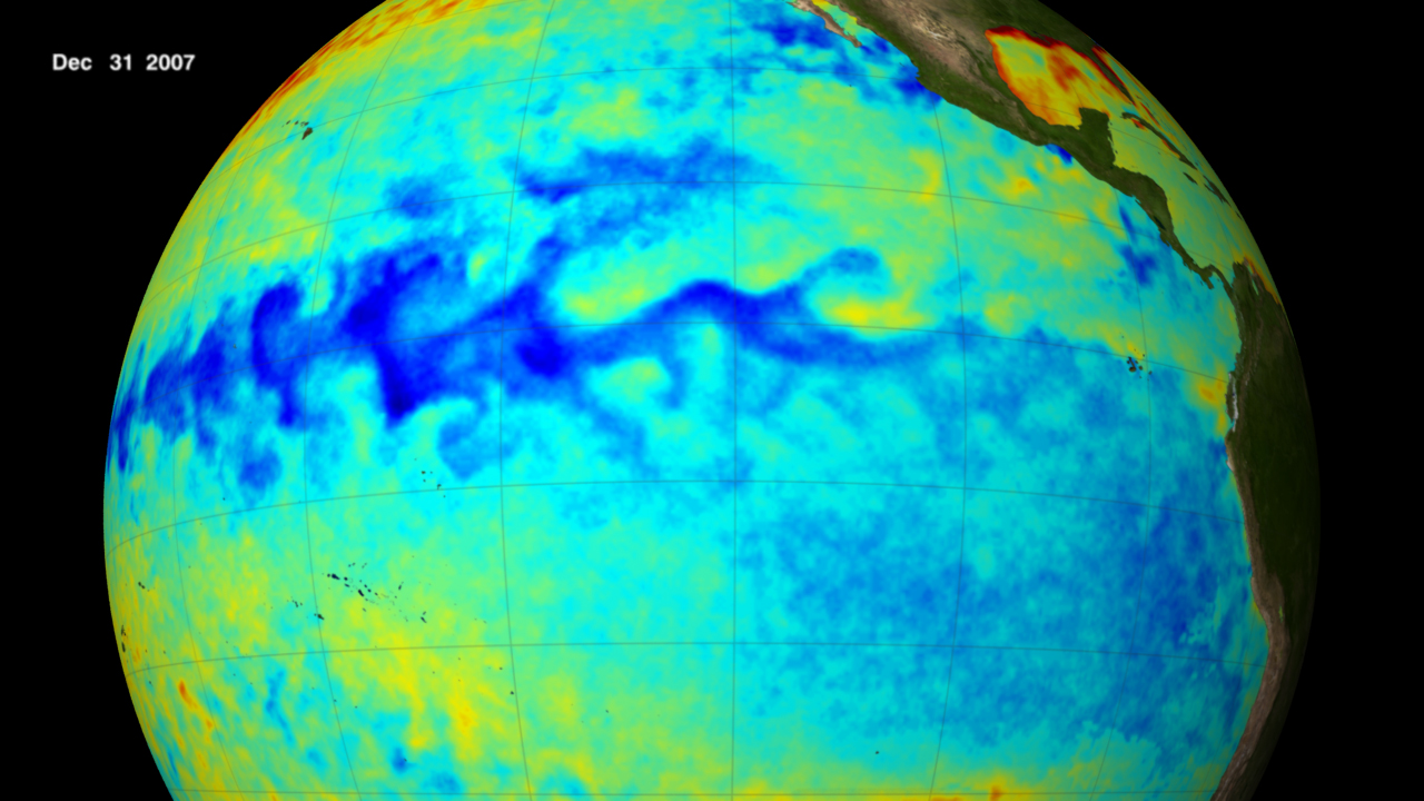
(Photo credit: NOAA. Thermal satellite image of La Nina, 2007)
It’s nearly October, so the countdown to ski season is on. Which means the winter weather predictions are starting to come in fast and furious.
To be honest, most of these are pretty worthless. Last fall I interviewed Joel Gratz, founder and chief meteorologist of OpenSnow.com, who said the following:
Forecasts for temperature and precipitation 3 to 6 months into the future are rarely accurate. And even if one forecasting outlet does produce an accurate forecast one year, it’s even rarer for the forecast to be correct year after year after year. Also, even if a 3 to 6 month forecast was correct, it only provides a general idea of precipitation patterns and cannot tell you which week or even which month will bring the best snow. I find 3 to 6 month forecasts fun to look at but I do not make travel decisions based on these predictions.
Nonetheless, I doubt there’s anyone reading this blog who doesn’t look at the long range predictions. As skiers, we long for snow, and anything that says we’re going to get it, reliable or not, makes us feel a whole lot better.
This year NOAA is predicting the high likelihood of a La Niña. I don’t know about you, but I get El Niño and La Niña mixed up all the time. So, in a nutshell, here’s the difference (from climate.gov):
El Niño and La Niña are the warm and cool phases of a recurring climate pattern across the tropical Pacific — the El Niño-Southern Oscillation, or “ENSO,” for short. An El Niño year is characterized by above-average sea surface temperatures in the central and eastern tropical Pacific Ocean. Over Indonesia, rainfall tends to become reduced while rainfall increases over the tropical Pacific Ocean. The low-level surface winds, which normally blow from east to west along the equator, instead weaken or, in some cases, start blowing the other direction. Conversely, in a La Niña year, the ocean surface temperatures in the eastern and central tropical Pacific are below average. As a result, rainfall over Indonesia tends to increase while rainfall decreases over the central tropical Pacific Ocean. The normal easterly winds along the equator become stronger. The pattern of El Nino/La Nina can shift back and forth irregularly every two to seven years, and each phase triggers disruptions of temperature, precipitation, and winds. These changes disrupt the large-scale air movements in the tropics, triggering a cascade of global side effects.
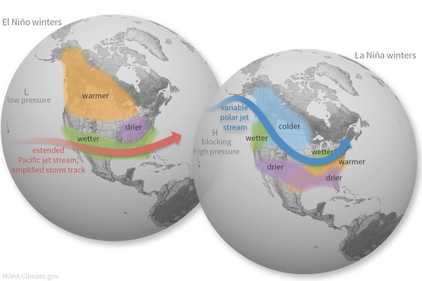
From NOAA
So what does La Niña mean for skiers in the US?
I’m no meteorologist, so I can’t even begin to a guess. But here’s a roundup of some of the predictions I’m seeing for the coming year:
Farmer’s Almanac: This is the gorilla in the room. It’s the one that gets a lot of attention and seems to be quoted the most. So here’s what it’s calling for in 2021: Uncommonly chilly temperatures will be limited mostly to the western states and northeastern New England. … Snowfall will be greater than normal in the Northeast, Wisconsin, Upper Michigan, the High Plains, and northern Alaska and below normal in most other areas that receive snow.
CNN meteorologist Brandon Miller said in July: “La Niña tends to pull down global temperatures, but in recent years we have been warming the planet so fast, it’s like hitting a small speed bump at 80 mph — it barely even registers.”
CBS Denver‘s weekend meteorologist, Chris Spears: “During a La Niña winter the polar jet stream, which drives weather patterns in the Northern Hemisphere, favors a northern track. In the western United States that means the northern Rocky Mountains tend to be colder and wetter than normal. The south often ends up warm and dry. Because Colorado is stuck in between, we usually experience a wide variety of conditions from north to south….The last La Niña winter in the United States was 2017-2018. It was meager for snow in places like Denver with only 25.7 inches for the season.”
The Climate Prediction Center at NOAA: We’ll see above-average snowfall in Montana, Wyoming, and the Midwest. Northern Colorado could also see an increased chance of precipitation starting in March. For the rest of the west, including Colorado, Utah, California, Nevada, Idaho, and the Pacific Northwest, there’s an equal chance for average snowfall. The areas that could come up short on snowfall this winter include Arizona and New Mexico.
Direct Weather. This is a Youtube channel with 100,ooo subscribers. According to Direct Weather, it’s going to be cold and stormy in the Pacific Northwest, with above average mountain snow in the Rockies, and the most above-average snowfall occurring in New England.
Weather Underground; Above-average temperatures are expected in late Fall in the Northwest and New England, but December could be colder than average, especially in parts of the northern and eastern US.
The safest bet for the weather? Again, from my interview with meteorologist Joel Gratz : It will snow. There will be powder. People will be both happy at times, and at times they will be mad that it’s not snowing more. That’s the only safe winter forecast!