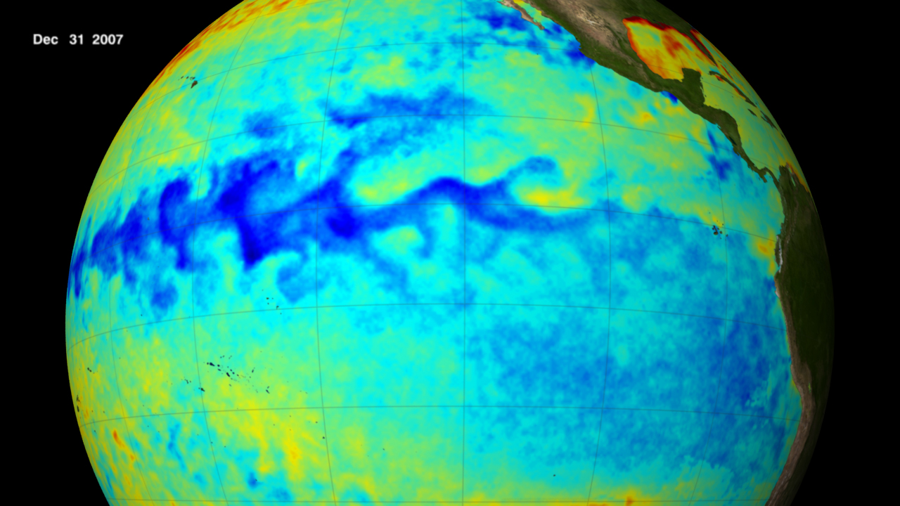
(Photo credit: NOAA. Thermal satellite image of La Nina, 2007)
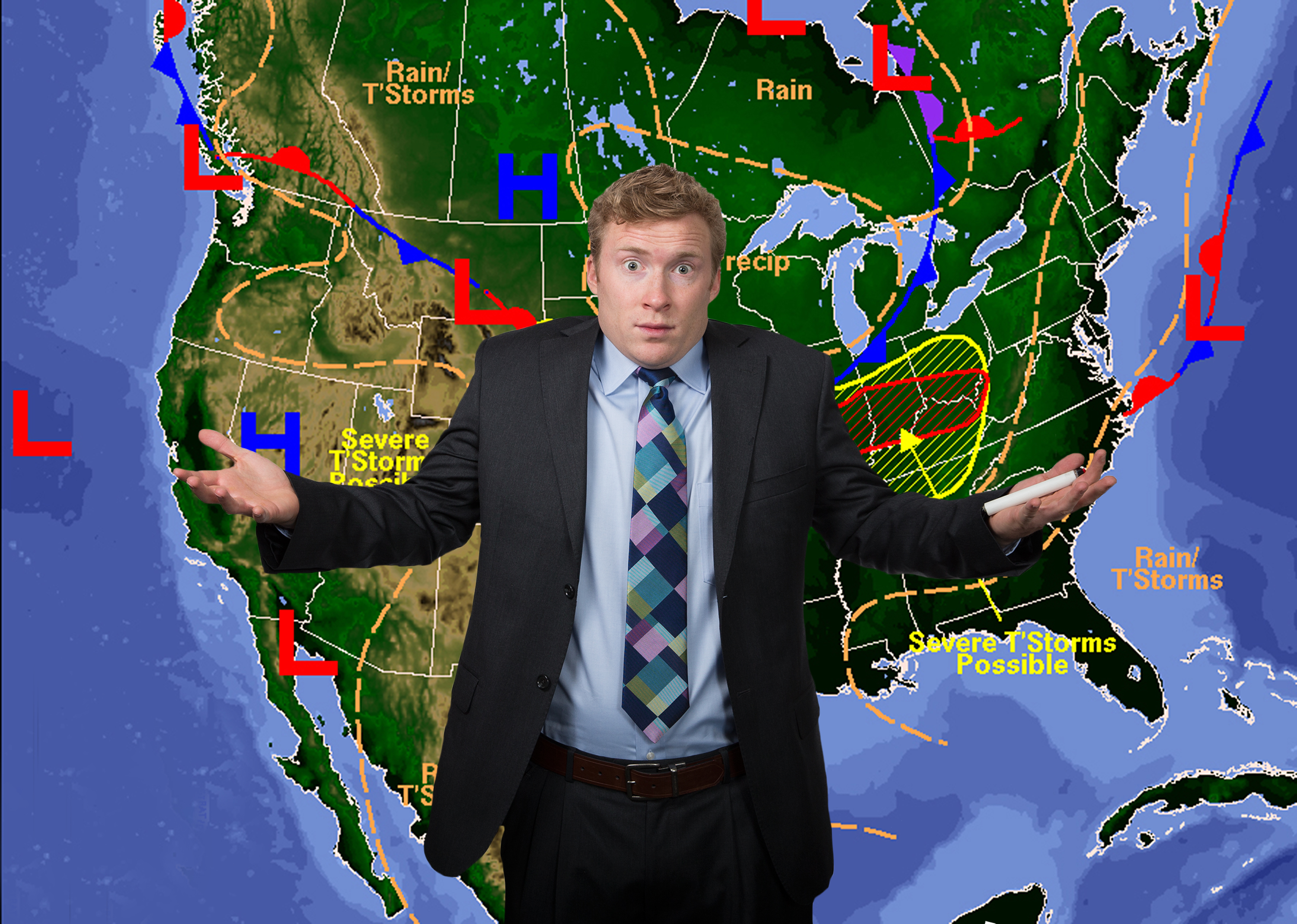
It’s nearly October, so the countdown to ski season is on. Which means the winter weather predictions are starting to come in fast and furious.
To be honest, most of these are pretty worthless. A few years ago I interviewed Joel Gratz, founder and chief meteorologist of OpenSnow.com, who said the following:
Forecasts for temperature and precipitation 3 to 6 months into the future are rarely accurate. And even if one forecasting outlet does produce an accurate forecast one year, it’s even rarer for the forecast to be correct year after year after year. Also, even if a 3 to 6 month forecast was correct, it only provides a general idea of precipitation patterns and cannot tell you which week or even which month will bring the best snow. I find 3 to 6 month forecasts fun to look at but I do not make travel decisions based on these predictions.
Nonetheless, I doubt there’s anyone reading this blog who doesn’t look at the long range predictions. As skiers, we long for snow, and anything that says we’re going to get it, reliable or not, makes us feel a whole lot better.
This year the World Meteorological Organization is predicting a continuation of the current La Niña over the next six months, with a 70% chance in September throughNovember but gradually decreasing to 55% in December through February. This will make it the century’s first “triple-dip“ La Niña, spanning three consecutive northern hemisphere winters. “It is exceptional to have three consecutive years with a la Niña event,” said WMO Secretary-General Prof. Petteri Taalas. “Its cooling influence is temporarily slowing the rise in global temperatures – but it will not halt or reverse the long-term warming trend,”
I don’t know about you, but I get El Niño and La Niña mixed up all the time.
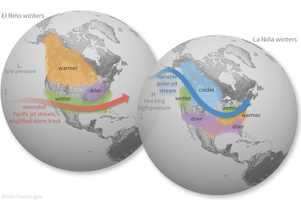
So, in a nutshell, here’s the difference (from climate.gov):
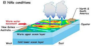
El Niño and La Niña are the warm and cool phases of a recurring climate pattern across the tropical Pacific — the El Niño-Southern Oscillation, or “ENSO,” for short. An El Niño year is characterized by above-average sea surface temperatures in the central and eastern tropical Pacific Ocean. Over Indonesia, rainfall tends to become reduced while rainfall increases over the tropical Pacific Ocean. The low-level surface winds, which normally blow from east to west along the equator, instead weaken or, in some cases, start blowing the other direction. Conversely, in a La Niña year, the ocean surface temperatures in the eastern and central tropical Pacific are below average. As a result, rainfall over Indonesia tends to increase while rainfall decreases over the central tropical Pacific Ocean. The normal easterly winds along the equator become stronger. The pattern of El Nino/La Nina can shift back and forth irregularly every two to seven years, and each phase triggers disruptions of temperature, precipitation, and winds. These changes disrupt the large-scale air movements in the tropics, triggering a cascade of global side effects.
From NOAA
So what does this mean for US skiers?
I’m no meteorologist, so I can’t even begin to a guess. But the bottom line is this: El Niño can bring rainier, cooler conditions to much of the Southern US and warmer conditions to parts of the North. La Niña, on the other hand, can lead to warm and dry conditions in the Southern US, and cooler, wetter weather in parts of the North, especially the Pacific Northwest.
Here’s a roundup of some of the predictions I’m seeing for the coming year:
Farmer’s Almanac: This is the gorilla in the room. It’s the one that gets a lot of attention and seems to be quoted the most. So here’s what it’s calling for in ’22-’23: Winter temperatures will be colder than normal across much of the country between the East Coast and Rockies. Snowfall will be greater than normal from central New England through northern North Carolina, from the Lower Great Lakes and the Ohio and Tennessee Valleys into the southern Plains, from the northern Plains into eastern Washington, and across the higher terrain of the southern Rockies and California. Freezing temperatures will also bring above-average snow totals to most areas in the eastern U.S. that typically experience snowfall.
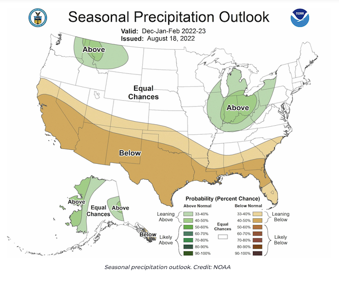
The Climate Prediction Center at NOAA:The outlook for December-January-February now slightly favors below-normal temperatures from the Pacific Northwest to the Northern Plains. Precipitation is forecast at above normal in the Pacific Northwest and Northern Rockies, with below normal precipitation across the Southwest and Southern California.
Direct Weather. This is a Youtube channel with 245,ooo subscribers. According to Direct Weather, there’s going to be above-average precipitation in the Northern Rockies, Pacific Northwest, Upper Plains, and Northeast with the most precipitation falling the the PNW, Ohio Valley, and interior Northeast. There will also be below average temperatures in the east and Northern Plains, with warmer temps in the West.
Powderchasers; Things are shaping up quite favorably for precipitation in the Western US, with normal to just below average in the East. The most snow-sure areas will be found in the Pacific Northwest and will extend to the southeast into Northern Utah, Wyoming, and northern Colorado. California could be boom or bust; which one remains to be seen.
The safest bet for the weather? Again, from my interview with meteorologist Joel Gratz :
It will snow. There will be powder. People will be both happy at times, and at times they will be mad that it’s not snowing more. That’s the only safe winter forecast!